What Is Geolocation
Geolocation refers to the location (in terms of its
geographical position–its latitude and longitude) of a device that is connected
to the internet.
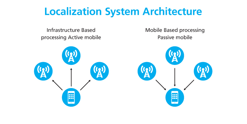
Typically, a geolocation system begins with a mobile device of some sort, be it a smartphone, for example, or an embedded sensor attached to a thing or a person. This device sends messages to a networking structure in the cloud that can compute the location of the device. This information can then be processed and presented in a visual fashion via an application such as a map. This is referred to as infrastructure-based processing, or active mobile processing.
Generally, this type of geolocation mechanism works the other way around as well. The mobile device can receive location information from the networking infrastructure and compute a location. This is called mobile-based processing or passive mobile processing since the device does not send any messages that are used to compute its location. One example of this is the GPS navigation system that is commonly used in cars.

Localization System Architecture
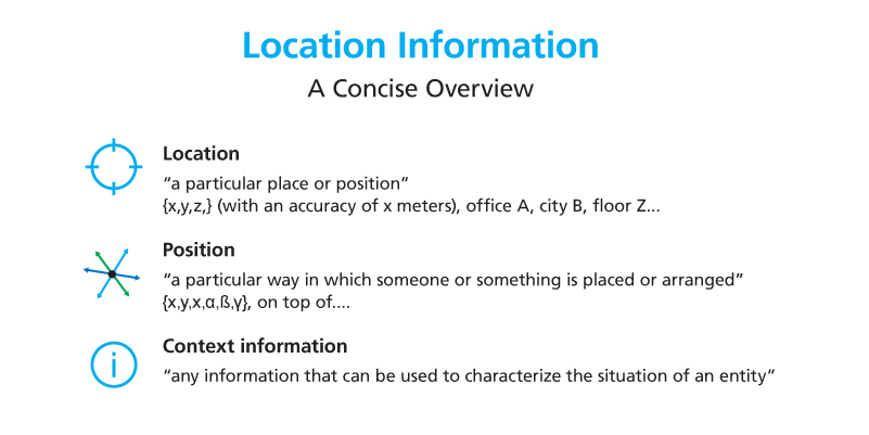
Location information can be very diverse. To begin with, there is a difference between a location and a position:
- Location: a particular place that can be expressed in terms of coordinates (x,y,z).
- Position: the way someone or something is placed or arranged. In addition to the coordinates, this can include the rotation of a device, or a description of how the device is related to some other object, for example, on top of or next to the second object.
We also need to take context into account. The term context is much broader than location and position. Context comprises any information that can be used to characterize the situation of an entity. This can not only be a location or a position, it can also include time information, environmental conditions such as temperature and humidity, or the presence of other assets in the area.

Overview of Location Information